PO BOX 505, Wyandotte, OK 74370, USA
Phone 01-918-542-4148
Phone Hours: 9-3 CT/M-Th | Emails generally answered within one working day
Click here for our Montague County Books
Texas Land Survey Map Series: An indispensable book for any serious professional or researcher interested in the County's history or land (or both), or its first landowners after Texas's Independence from Mexico. Each book in this series is laid out into multiple maps using a 6 mile high by 4 mile wide grid. This book contains approximately 48 such Land Survey maps. Each Land Survey Map shows the boundaries of original parcels laid out over existing roads, railroads, waterways. These are shown as well as the original Survey-Name (person responsible for the survey) and the Abstract Number assigned by the Texas General Land Office to the instrument that gave ownership to that parcel. Beyond the County Land Survey maps, there are equally useful indexes to give you the real details behind each parcel of land and its original survey-name and ownership.
 Texas Land Survey Maps for
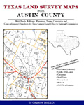
Austin
Co., by Boyd. 8.5x11”, 132 pages, spiral softbound book. 47
maps, an indispensable book for any researcher interested
in Austin County's history or land (or both), or its first
landowners after Texas's Independence from Mexico. Each book
in this series is laid out into multiple maps using a 6 mile
high by 4 mile wide grid. This book contains 42 Survey maps
laid out within this grid. Each Land Survey Map shows the
boundaries of original parcels laid out over existing roads,
railroads, waterways. These are shown as well as the
original Survey-Name and the Abstract Number assigned by the
Texas General Land Office to the instrument that gave
ownership to that parcel.
ADAR430-$29.00
Texas Land Survey Maps for
Austin
Co., by Boyd. 8.5x11”, 132 pages, spiral softbound book. 47
maps, an indispensable book for any researcher interested
in Austin County's history or land (or both), or its first
landowners after Texas's Independence from Mexico. Each book
in this series is laid out into multiple maps using a 6 mile
high by 4 mile wide grid. This book contains 42 Survey maps
laid out within this grid. Each Land Survey Map shows the
boundaries of original parcels laid out over existing roads,
railroads, waterways. These are shown as well as the
original Survey-Name and the Abstract Number assigned by the
Texas General Land Office to the instrument that gave
ownership to that parcel.
ADAR430-$29.00
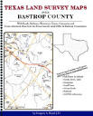 Texas
Land Survey Maps for Bastrop County, by Gregory A.
Boyd. 8.5x11", spiral softbound book, 156 pages with 59
maps. An indispensable book for any researcher interested
in Bastrop County's history or land
(or both), or its first landowners after Texas's
Independence from Mexico. Each book in this series is
laid out into multiple maps using a 6 mile high by 4 mile
wide grid. This book contains 54 Survey maps laid out within
this grid. Each Land Survey Map shows the boundaries of
original parcels laid out over existing roads, railroads,
waterways. These are shown as well as the original
Survey-Name and the Abstract Number assigned by the Texas
General Land Office to the instrument that gave ownership to
that parcel.
ADAR469-$33.00
Texas
Land Survey Maps for Bastrop County, by Gregory A.
Boyd. 8.5x11", spiral softbound book, 156 pages with 59
maps. An indispensable book for any researcher interested
in Bastrop County's history or land
(or both), or its first landowners after Texas's
Independence from Mexico. Each book in this series is
laid out into multiple maps using a 6 mile high by 4 mile
wide grid. This book contains 54 Survey maps laid out within
this grid. Each Land Survey Map shows the boundaries of
original parcels laid out over existing roads, railroads,
waterways. These are shown as well as the original
Survey-Name and the Abstract Number assigned by the Texas
General Land Office to the instrument that gave ownership to
that parcel.
ADAR469-$33.00
 Texas Land Survey Maps for
Bell County, Texas, by Gregory A. Boyd. 8.5x11",
spiral
softbound book, 228 pages with 70 maps.
ADAR337-$36.00
Texas Land Survey Maps for
Bell County, Texas, by Gregory A. Boyd. 8.5x11",
spiral
softbound book, 228 pages with 70 maps.
ADAR337-$36.00
 Texas Land Survey Maps for
Bosque County,
by Gregory A. Boyd.
8.5x11”, 214 pages, spiral softbound book. 66 maps, an
indispensable book for any researcher interested in Bosque
County's history or land (or both), or its first landowners
after Texas's Independence from Mexico. Each book in this
series is laid out into multiple maps using a 6 mile high by
4 mile wide grid. This book contains 61 Survey maps laid out
within this grid. Each Land Survey Map shows the boundaries
of original parcels laid out over existing roads, railroads,
waterways. These are shown as well as the original
Survey-Name and the Abstract Number assigned by the Texas
General Land Office to the instrument that gave ownership to
that parcel. ADAR431-$36.00
Texas Land Survey Maps for
Bosque County,
by Gregory A. Boyd.
8.5x11”, 214 pages, spiral softbound book. 66 maps, an
indispensable book for any researcher interested in Bosque
County's history or land (or both), or its first landowners
after Texas's Independence from Mexico. Each book in this
series is laid out into multiple maps using a 6 mile high by
4 mile wide grid. This book contains 61 Survey maps laid out
within this grid. Each Land Survey Map shows the boundaries
of original parcels laid out over existing roads, railroads,
waterways. These are shown as well as the original
Survey-Name and the Abstract Number assigned by the Texas
General Land Office to the instrument that gave ownership to
that parcel. ADAR431-$36.00
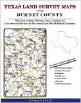 Texas Land Survey Maps for
Burnet County,
Texas, by Gregory A. Boyd. 8.5x11",
spiral softbound book, 170 pages. Other Maps Included: Where Burnet
County Lies Within the State (Map A); Burnet County and its Surrounding Counties
(Map B); An Index Map showing where each of the Land Survey Maps are within
Burnet County (Map C); An Index Map that builds upon Map C and shows the
community-center points in relationship to the county-grid (Map D); An Index Map
that builds upon Map C and shows cemeteries listed in the USGS database in
relationship to the county-grid (Map E). The primary indexes (apart from each
Survey-Map's own index of survey-names): An All-Name Index (alphabetical by
last-name) for every person mentioned in the maps, utilizing both Texas General
Land Office and Texas Railroad Commission data and the Abstract Listing: this is
where you find the real details behind each parcel of land. Items are listed by
Abstract Number.
ADAR030-$33.00
Texas Land Survey Maps for
Burnet County,
Texas, by Gregory A. Boyd. 8.5x11",
spiral softbound book, 170 pages. Other Maps Included: Where Burnet
County Lies Within the State (Map A); Burnet County and its Surrounding Counties
(Map B); An Index Map showing where each of the Land Survey Maps are within
Burnet County (Map C); An Index Map that builds upon Map C and shows the
community-center points in relationship to the county-grid (Map D); An Index Map
that builds upon Map C and shows cemeteries listed in the USGS database in
relationship to the county-grid (Map E). The primary indexes (apart from each
Survey-Map's own index of survey-names): An All-Name Index (alphabetical by
last-name) for every person mentioned in the maps, utilizing both Texas General
Land Office and Texas Railroad Commission data and the Abstract Listing: this is
where you find the real details behind each parcel of land. Items are listed by
Abstract Number.
ADAR030-$33.00
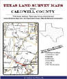 Texas
Land Survey Maps for Caldwell County, Texas, by
Gregory A. Boyd. 8.5x11",
spiral softbound book, 118 pages. ADAR338-$28.00
Texas
Land Survey Maps for Caldwell County, Texas, by
Gregory A. Boyd. 8.5x11",
spiral softbound book, 118 pages. ADAR338-$28.00
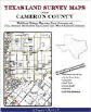 Texas Land Survey Maps for
Cameron
County, Texas, by G. A. Boyd. 234 pages, 8.5x11",
spiral
softbound
book.
ADAR395-$33.00
Texas Land Survey Maps for
Cameron
County, Texas, by G. A. Boyd. 234 pages, 8.5x11",
spiral
softbound
book.
ADAR395-$33.00
 Texas Land Survey Maps for
Collin County,
Texas, by Boyd. 172 pages, 8.5x11",
spiral
softbound
book. ADAR394-$33.00
Texas Land Survey Maps for
Collin County,
Texas, by Boyd. 172 pages, 8.5x11",
spiral
softbound
book. ADAR394-$33.00
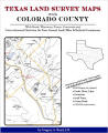 Texas
Land Survey Maps for Colorado County, Texas, by Gregory Boyd. 202 pages, 8.5x11",
spiral
softbound
book. ADAR393-$36.00
Texas
Land Survey Maps for Colorado County, Texas, by Gregory Boyd. 202 pages, 8.5x11",
spiral
softbound
book. ADAR393-$36.00
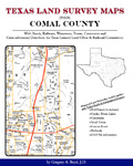 Texas Land Survey Maps for
Comal County, Texas, by Gregory A. Boyd. 8.5x11",
160 pages,
spiral
softbound
book, includes 45 maps.
ADAR425-$33.00
Texas Land Survey Maps for
Comal County, Texas, by Gregory A. Boyd. 8.5x11",
160 pages,
spiral
softbound
book, includes 45 maps.
ADAR425-$33.00
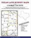 Texas Land Survey Maps
for Cooke County, Texas, by Gregory A. Boyd. 8.5x11",
spiral softbound book, 234 pages.
ADAR339-$36.00
Texas Land Survey Maps
for Cooke County, Texas, by Gregory A. Boyd. 8.5x11",
spiral softbound book, 234 pages.
ADAR339-$36.00
 Texas Land Survey Maps for
Denton County, Texas, by Gregory A. Boyd. 8.5x11",
spiral softbound book, 238 pages.
ADAR340-$36.00
Texas Land Survey Maps for
Denton County, Texas, by Gregory A. Boyd. 8.5x11",
spiral softbound book, 238 pages.
ADAR340-$36.00
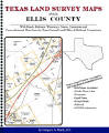 Texas Land Survey Maps for
Ellis County, by
Gregory A. Boyd. 8.5x11", spiral softbound book, 214 pages
with 56 maps. An indispensable book for any researcher
interested in Ellis County's history or land (or both), or
its first landowners after Texas's Independence from Mexico.
Each book in this series is laid out into multiple maps
using a 6 mile high by 4 mile wide grid. This book contains
51 Survey maps laid out within this grid. Each Land Survey
Map shows the boundaries of original parcels laid out over
existing roads, railroads, waterways. These are shown as
well as the original Survey-Name and the Abstract Number
assigned by the Texas General Land Office to the instrument
that gave ownership to that parcel.
ADAR468-$36.00
Texas Land Survey Maps for
Ellis County, by
Gregory A. Boyd. 8.5x11", spiral softbound book, 214 pages
with 56 maps. An indispensable book for any researcher
interested in Ellis County's history or land (or both), or
its first landowners after Texas's Independence from Mexico.
Each book in this series is laid out into multiple maps
using a 6 mile high by 4 mile wide grid. This book contains
51 Survey maps laid out within this grid. Each Land Survey
Map shows the boundaries of original parcels laid out over
existing roads, railroads, waterways. These are shown as
well as the original Survey-Name and the Abstract Number
assigned by the Texas General Land Office to the instrument
that gave ownership to that parcel.
ADAR468-$36.00
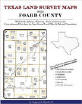 Texas Land Survey Maps for
Foard County, Texas, by Gregory A. Boyd.
190 pages, 8.5x11",
spiral
softbound
book. ADAR396-$33.00
Texas Land Survey Maps for
Foard County, Texas, by Gregory A. Boyd.
190 pages, 8.5x11",
spiral
softbound
book. ADAR396-$33.00
 Texas Land Survey
Maps for Grayson County, Texas, by Gregory A. Boyd. 242 pages, 8.5x11",
spiral
softbound book. ADAR397-$36.00
Texas Land Survey
Maps for Grayson County, Texas, by Gregory A. Boyd. 242 pages, 8.5x11",
spiral
softbound book. ADAR397-$36.00
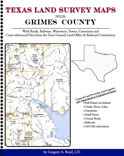 Texas Land Survey Maps for
Grimes County, by Gregory A. Boyd. 8.5x11", spiral softbound book,
146 pages with 52 maps. An indispensable book for any
researcher interested in Grimes County's history or land (or
both), or its first landowners after Texas's Independence
from Mexico. Each book in this series is laid out into
multiple maps using a 6 mile high by 4 mile wide grid. This
book contains 47 Survey maps laid out within this grid. Each
Land Survey Map shows the boundaries of original parcels
laid out over existing roads, railroads, waterways. These
are shown as well as the original Survey-Name and the
Abstract Number assigned by the Texas General Land Office to
the instrument that gave ownership to that parcel.
ADAR471-$29.00
Texas Land Survey Maps for
Grimes County, by Gregory A. Boyd. 8.5x11", spiral softbound book,
146 pages with 52 maps. An indispensable book for any
researcher interested in Grimes County's history or land (or
both), or its first landowners after Texas's Independence
from Mexico. Each book in this series is laid out into
multiple maps using a 6 mile high by 4 mile wide grid. This
book contains 47 Survey maps laid out within this grid. Each
Land Survey Map shows the boundaries of original parcels
laid out over existing roads, railroads, waterways. These
are shown as well as the original Survey-Name and the
Abstract Number assigned by the Texas General Land Office to
the instrument that gave ownership to that parcel.
ADAR471-$29.00
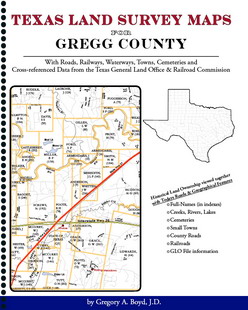 Texas Land Survey Maps for
Gregg County, by Gregory A. Boyd. 8.5x11", spiral softbound book,
76 pages with 24 maps. An indispensable book for any
researcher interested in Gregg County's history or land (or
both), or its first landowners after Texas's Independence
from Mexico. Each book in this series is laid out into
multiple maps using a 6 mile high by 4 mile wide grid. This
book contains 19 Survey maps laid out within this grid. Each
Land Survey Map shows the boundaries of original parcels
laid out over existing roads, railroads, waterways. These
are shown as well as the original Survey-Name and the
Abstract Number assigned by the Texas General Land Office to
the instrument that gave ownership to that parcel.
ADAR470-$25.00
Texas Land Survey Maps for
Gregg County, by Gregory A. Boyd. 8.5x11", spiral softbound book,
76 pages with 24 maps. An indispensable book for any
researcher interested in Gregg County's history or land (or
both), or its first landowners after Texas's Independence
from Mexico. Each book in this series is laid out into
multiple maps using a 6 mile high by 4 mile wide grid. This
book contains 19 Survey maps laid out within this grid. Each
Land Survey Map shows the boundaries of original parcels
laid out over existing roads, railroads, waterways. These
are shown as well as the original Survey-Name and the
Abstract Number assigned by the Texas General Land Office to
the instrument that gave ownership to that parcel.
ADAR470-$25.00
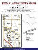 Texas
Land Survey Maps for Hall County, Texas, by Gregory
A. Boyd. 8.5x11",
spiral softbound book, 188 pages.
ADAR341-$33.00
Texas
Land Survey Maps for Hall County, Texas, by Gregory
A. Boyd. 8.5x11",
spiral softbound book, 188 pages.
ADAR341-$33.00
 Texas Land Survey Maps for
Hardin County, Texas, by Gregory A. Boyd. 8.5x11",
spiral softbound book, 53 maps, 174 pages.
AD2261-$33.00
Texas Land Survey Maps for
Hardin County, Texas, by Gregory A. Boyd. 8.5x11",
spiral softbound book, 53 maps, 174 pages.
AD2261-$33.00
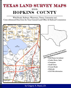 Texas Land Survey Maps for
Hopkins County, by Gregory A. Boyd. 8.5x11", spiral softbound book,
188 pages with 49 maps. An indispensable book for any
researcher interested in Hopkins County's history or land
(or both), or its first landowners after Texas's
Independence from Mexico. Each book in this series is laid
out into multiple maps using a 6 mile high by 4 mile wide
grid. This book contains 44 Survey maps laid out within this
grid. Each Land Survey Map shows the boundaries of original
parcels laid out over existing roads, railroads,
waterways. These are shown as well as the original
Survey-Name and the Abstract Number assigned by the Texas
General Land Office to the instrument that gave ownership to
that parcel.
ADAR472-$33.00
Texas Land Survey Maps for
Hopkins County, by Gregory A. Boyd. 8.5x11", spiral softbound book,
188 pages with 49 maps. An indispensable book for any
researcher interested in Hopkins County's history or land
(or both), or its first landowners after Texas's
Independence from Mexico. Each book in this series is laid
out into multiple maps using a 6 mile high by 4 mile wide
grid. This book contains 44 Survey maps laid out within this
grid. Each Land Survey Map shows the boundaries of original
parcels laid out over existing roads, railroads,
waterways. These are shown as well as the original
Survey-Name and the Abstract Number assigned by the Texas
General Land Office to the instrument that gave ownership to
that parcel.
ADAR472-$33.00
 Texas Land Survey Maps for
Hunt County, by Gregory A. Boyd. 8.5x11", spiral softbound book,
198 pages with 52 maps. An indispensable book for any
researcher interested in Hunt County's history or land (or
both), or its first landowners after Texas's Independence
from Mexico. Each book in this series is laid out into
multiple maps using a 6 mile high by 4 mile wide grid. This
book contains 47 Survey maps laid out within this grid. Each
Land Survey Map shows the boundaries of original parcels
laid out over existing roads, railroads, waterways. These
are shown as well as the original Survey-Name and the
Abstract Number assigned by the Texas General Land Office to
the instrument that gave ownership to that parcel.
ADAR473-$33.00
Texas Land Survey Maps for
Hunt County, by Gregory A. Boyd. 8.5x11", spiral softbound book,
198 pages with 52 maps. An indispensable book for any
researcher interested in Hunt County's history or land (or
both), or its first landowners after Texas's Independence
from Mexico. Each book in this series is laid out into
multiple maps using a 6 mile high by 4 mile wide grid. This
book contains 47 Survey maps laid out within this grid. Each
Land Survey Map shows the boundaries of original parcels
laid out over existing roads, railroads, waterways. These
are shown as well as the original Survey-Name and the
Abstract Number assigned by the Texas General Land Office to
the instrument that gave ownership to that parcel.
ADAR473-$33.00
 Texas Land Survey Maps for
Lavaca County, Texas, by Gregory A. Boyd. 8.5x11",
spiral softbound book, 176 pages.
ADAR342-$33.00
Texas Land Survey Maps for
Lavaca County, Texas, by Gregory A. Boyd. 8.5x11",
spiral softbound book, 176 pages.
ADAR342-$33.00
 Texas Land Survey Maps for
Leon County, Texas, by Gregory A. Boyd.
320 pages, 8.5x11",
spiral
softbound
book. ADAR398-$36.00
Texas Land Survey Maps for
Leon County, Texas, by Gregory A. Boyd.
320 pages, 8.5x11",
spiral
softbound
book. ADAR398-$36.00
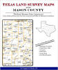 Texas Land Survey Maps for Mason County, Texas, by Gregory A. Boyd. 8.5x11",
spiral
softbound
book, 53 maps, 234 pages. ADAR405-$36.00
Texas Land Survey Maps for Mason County, Texas, by Gregory A. Boyd. 8.5x11",
spiral
softbound
book, 53 maps, 234 pages. ADAR405-$36.00
 Texas Land Survey Maps for
Medina County, by Gregory A. Boyd. 8.5x11", spiral softbound book,
284 pages with 75 maps. An indispensable book for any
researcher interested in Medina County's history or land (or
both), or its first landowners after Texas's Independence
from Mexico. Each book in this series is laid out into
multiple maps using a 6 mile high by 4 mile wide grid. This
book contains 70 Survey maps laid out within this grid. Each
Land Survey Map shows the boundaries of original parcels
laid out over existing roads, railroads, waterways. These
are shown as well as the original Survey-Name and the
Abstract Number assigned by the Texas General Land Office to
the instrument that gave ownership to that parcel.
ADAR474-$38.00
Texas Land Survey Maps for
Medina County, by Gregory A. Boyd. 8.5x11", spiral softbound book,
284 pages with 75 maps. An indispensable book for any
researcher interested in Medina County's history or land (or
both), or its first landowners after Texas's Independence
from Mexico. Each book in this series is laid out into
multiple maps using a 6 mile high by 4 mile wide grid. This
book contains 70 Survey maps laid out within this grid. Each
Land Survey Map shows the boundaries of original parcels
laid out over existing roads, railroads, waterways. These
are shown as well as the original Survey-Name and the
Abstract Number assigned by the Texas General Land Office to
the instrument that gave ownership to that parcel.
ADAR474-$38.00
Click here for our Montague County Books
 Texas
Land Survey Maps for Nacogdoches County, Texas, by Gregory A. Boyd.
180 pages, 8.5x11",
spiral
softbound
book. ADAR399-$33.00
Texas
Land Survey Maps for Nacogdoches County, Texas, by Gregory A. Boyd.
180 pages, 8.5x11",
spiral
softbound
book. ADAR399-$33.00
 Texas Land Survey Maps for
Navarro County,
Texas, by Gregory A. Boyd. 214
pages, 8.5x11",
spiral
softbound
book. ADAR400-$36.00
Texas Land Survey Maps for
Navarro County,
Texas, by Gregory A. Boyd. 214
pages, 8.5x11",
spiral
softbound
book. ADAR400-$36.00
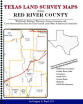 Texas Land Survey Maps for Red River County, by Gregory A. Boyd. 8.5x11", spiral softbound book,
230 pages with 62 maps. An indispensable book for any
researcher interested in Red River County's history or land
(or both), or its first landowners after Texas's
Independence from Mexico. Each book in this series is laid
out into multiple maps using a 6 mile high by 4 mile wide
grid. This book contains 57 Survey maps laid out within this
grid. Each Land Survey Map shows the boundaries of original
parcels laid out over existing roads, railroads,
waterways. These are shown as well as the original
Survey-Name and the Abstract Number assigned by the Texas
General Land Office to the instrument that gave ownership to
that parcel.
ADAR475-$36.00
Texas Land Survey Maps for Red River County, by Gregory A. Boyd. 8.5x11", spiral softbound book,
230 pages with 62 maps. An indispensable book for any
researcher interested in Red River County's history or land
(or both), or its first landowners after Texas's
Independence from Mexico. Each book in this series is laid
out into multiple maps using a 6 mile high by 4 mile wide
grid. This book contains 57 Survey maps laid out within this
grid. Each Land Survey Map shows the boundaries of original
parcels laid out over existing roads, railroads,
waterways. These are shown as well as the original
Survey-Name and the Abstract Number assigned by the Texas
General Land Office to the instrument that gave ownership to
that parcel.
ADAR475-$36.00
 Texas Land Survey Maps for
Roberts County,
Texas, by Gregory A. Boyd. 8.5x11",
190 pages,
spiral
softbound
book. ADAR401-$33.00
Texas Land Survey Maps for
Roberts County,
Texas, by Gregory A. Boyd. 8.5x11",
190 pages,
spiral
softbound
book. ADAR401-$33.00
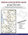 Texas Land Survey Maps for
Rusk County, Texas, by Gregory A. Boyd. 8.5x11",
spiral softbound book, 186 pages.
ADAR343-$33.00
Texas Land Survey Maps for
Rusk County, Texas, by Gregory A. Boyd. 8.5x11",
spiral softbound book, 186 pages.
ADAR343-$33.00
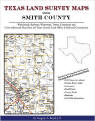 Texas Land Survey Maps for
Smith County, Texas, by Gregory A. Boyd.
210 pages, 8.5x11",
spiral
softbound.
ADAR402-$36.00
Texas Land Survey Maps for
Smith County, Texas, by Gregory A. Boyd.
210 pages, 8.5x11",
spiral
softbound.
ADAR402-$36.00
 Texas Land Survey Maps for
Taylor County, Texas, by Gregory A. Boyd. 8.5x11",
spiral softbound book, 238 pages.
ADAR334-$36.00
Texas Land Survey Maps for
Taylor County, Texas, by Gregory A. Boyd. 8.5x11",
spiral softbound book, 238 pages.
ADAR334-$36.00
 Texas Land Survey Maps for
Tom Green County, Texas, by Gregory A. Boyd. 8.5x11",
spiral softbound book, 328 pages.
ADAR335-$39.00
Texas Land Survey Maps for
Tom Green County, Texas, by Gregory A. Boyd. 8.5x11",
spiral softbound book, 328 pages.
ADAR335-$39.00
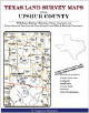 Texas Land Survey Maps for
Upshur County,
Texas, by Gregory A. Boyd. 8.5x11",
spiral
softbound
book, 36 maps, 124 pages.
ADAR346-$29.00
Texas Land Survey Maps for
Upshur County,
Texas, by Gregory A. Boyd. 8.5x11",
spiral
softbound
book, 36 maps, 124 pages.
ADAR346-$29.00
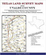 Texas Land Survey Maps for
Uvalde
County, Texas, by Gregory A. Boyd. 8.5x11",
spiral
softbound
book. 82 maps, 288 pages.
ADAR389-$38.00
Texas Land Survey Maps for
Uvalde
County, Texas, by Gregory A. Boyd. 8.5x11",
spiral
softbound
book. 82 maps, 288 pages.
ADAR389-$38.00
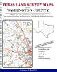 Texas Land Survey Maps for
Washington County, by Gregory A. Boyd. 8.5x11", spiral softbound book,
108 pages with 43 maps. An indispensable book for any
researcher interested in Washington County's history or land
(or both), or its first landowners after Texas's
Independence from Mexico. Each book in this series is laid
out into multiple maps using a 6 mile high by 4 mile wide
grid. This book contains 38 Survey maps laid out within this
grid. Each Land Survey Map shows the boundaries of original
parcels laid out over existing roads, railroads,
waterways. These are shown as well as the original
Survey-Name and the Abstract Number assigned by the Texas
General Land Office to the instrument that gave ownership to
that parcel.
ADAR476-$28.00
Texas Land Survey Maps for
Washington County, by Gregory A. Boyd. 8.5x11", spiral softbound book,
108 pages with 43 maps. An indispensable book for any
researcher interested in Washington County's history or land
(or both), or its first landowners after Texas's
Independence from Mexico. Each book in this series is laid
out into multiple maps using a 6 mile high by 4 mile wide
grid. This book contains 38 Survey maps laid out within this
grid. Each Land Survey Map shows the boundaries of original
parcels laid out over existing roads, railroads,
waterways. These are shown as well as the original
Survey-Name and the Abstract Number assigned by the Texas
General Land Office to the instrument that gave ownership to
that parcel.
ADAR476-$28.00
 Texas Land Survey Maps for Wood County, Texas, by Gregory A. Boyd. 8.5x11",
152 pages,
spiral
softbound
book, includes 47 maps. ADAR426-$33.00
Texas Land Survey Maps for Wood County, Texas, by Gregory A. Boyd. 8.5x11",
152 pages,
spiral
softbound
book, includes 47 maps. ADAR426-$33.00
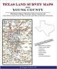 Texas
Land Survey Maps for
Young
County, Texas, by Gregory A. Boyd.
8.5x11",
spiral
softbound book, 53 maps, 270 pages.
ADAR390-$38.00
Texas
Land Survey Maps for
Young
County, Texas, by Gregory A. Boyd.
8.5x11",
spiral
softbound book, 53 maps, 270 pages.
ADAR390-$38.00
For more Texas books see also Military Records, Alabama, "B" and "K" Sections.
Ordering Information
Print
& mail order form
|
Pre-order
form
or
Click
& print program - even more online items!
![]()
![]()
Current Sale | Book Spotlight - changes periodically
All book sales final.
Gregath Website Home Page > Online Catalog Home Page > Book Catalog > State Books > Texas State Books
Page Last Updated: January 09, 2019
Basic Gregath Search
powered by FreeFind
Gregath Company
Website Table of Contents
Gregath Co., Inc.: Email Us |PO BOX 505, Wyandotte, OK 74370, USA | Phone 01-918-542-4148
All catalog sales final. Read about our shipping and handling charges for catalog orders.
We welcome suggestions and comments. Bookmark this page* for easy return.
Click Here to Bookmark This Site!
Copyright © Gregath Company, Incorporated
All rights reserved. All material on this site, including text, photographs, graphics, and code are protected by international copyright and trademark laws. Unauthorized use is not permitted. You may not modify, copy, reproduce, republish, upload, post, transmit or distribute, in any manner, the material on this website without prior permission.
Feel free to link to this page.